
April 13 - Stats: 19 km / 1010m gain / 834m high / 5:35 MT
We had a whopping big group of 23 this day. Must've been my after-the-hike desserts. Well as I was told, "I sure made them work for it". The thing is, the last time I did this hike was about 15 years ago. And with the lower trails being on private property and therefore not on my GPS, it was a bit hard to get the exact stats. Nevertheless, we all made it and we were all pretty happy to be back at my place by 4:00pm.

Almost ready to go.

I thought it best to do this hike when the trilliums were blooming and the deciduous trees were not out in full foliage yet. That way we could see the more distant views through them.

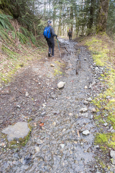
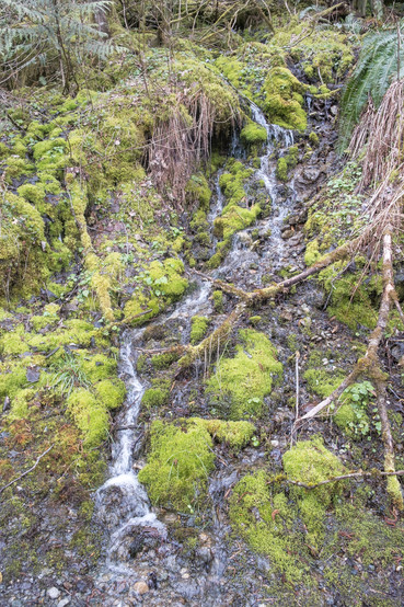
After climbing steeply up our Lucky trail (named after our neighbour who created these private trails), we turned right on the Vedder Mt. FSR. This is a huge washout left by the heavy rains in November.

The first viewpoint over Sumas Prairie. On the northern horizon are Golden Ears, Robie Reid + Judge Howay.

At the old barn, instead of turning right as we usually do, to get to what we call "Old Baldy", we stayed left.

I remember way back when Ron Dart was actually sitting on this raft and floating.

Past the ponds, we stayed left and climbed up a deactivated FSR which wound to the left. Got these see-through-the-tree views of Columbia Valley. I got a wee glimpse of the west end of Cultus Lake.


At the highest point of this road, we turned left and bushwhacked a bit onto this clear-cut area. This is the west end of Columbia Valley.


We could see Vancouver Island -- west.


It was 12:00 and the group thought it was lunch time. I'm not sure if they'll trust me again, because I said it wouldn't be that far to the paragliders lookout where it'd be nicer to have lunch. It turned out to take twice as long as I calculated.


This road started to drop downwards to the main more driven road where we turned left.

Then a final right on the Tower Rd where we had to climb once again. We didn't get any rain this day but it did start to snow! It was 1:30pm when we reached our destination, having left our place at 9:45am. This large group that started out chattering non-stop and scaring the deer away, was now very quiet. They were too busy eating and filling their very hungry tummies.

Group shot: Dave (first time), Margaret, Liz, Iraj, Bernadette, Johnny, Bill, Terry, Irene, Dave, Allana, Darlene, Vic, Peter, Don, Chalotte, Charlene, me, Sheri, Cal, Denise, Case + Jerry

Sumas Prairie and Mountain -- northwest to northeast.

View towards Chilliwack.

When we got back to the driven road, we kept going straight, onto the Rocky Creek trail.


Back on the Lucky trail. This is the steepest slope.

Time to relax and eat. I made my famous pumpkin-pecan dessert + carrot cake.


Then my daughter-in-law, Camille brought out her 5 puppies and my grandbaby. Good times.

Ignore all those grey lines coming from my house. That's what happens when I turn the GPS on before its plugged into the computer. The tourquoise line is where we hiked, starting right from our backyard.
Comentarios