
Salt Spring & Vancouver Islands
- Jocelyn Timmermans
- Oct 22, 2020
- 5 min read
I was able to knock 5 hikes off in the "105 Hikes in and around SW BC" book, in 2.5 days. This was possible because they were shorter hikes + although we did not have reservations, we did not have to wait more than 15 minutes for both ferries!
Day 1
Hike #1: Mt. Erskine on Salt Spring Island -- 6.26 km / 441m gain / 448m high point / 2:20 hours
We did the loop counter-clockwise.


The hairy manzanita bushes are relatives of the arbutus trees.

Case is in his element. He loves trees.

Booth Bay -- north. The ground looks like its metamorphasizing from soil to rocks to concrete.

More manzanita bushes.

A fairy's door.


3 pic slider: 1) A weeping wall. 2) Another fairy door. 3) Peeling Arbutus bark.

The Shoal Islands & Penelakut Island line Stuart Channel -- northwest.

Past the viewpoint we somehow ended up on the sketchy trail that the book warned us about. I didn't mind. We passed a cave below this overhang and scrambled up a rocky bluff when the trail petered out.


Made it to the highest viewpoint on the loop (climbing straight up the cliff).


Hike #2: Mt. Maxwell -- 8.18 km / 395m gain / 593m high / 2:50 hours MT
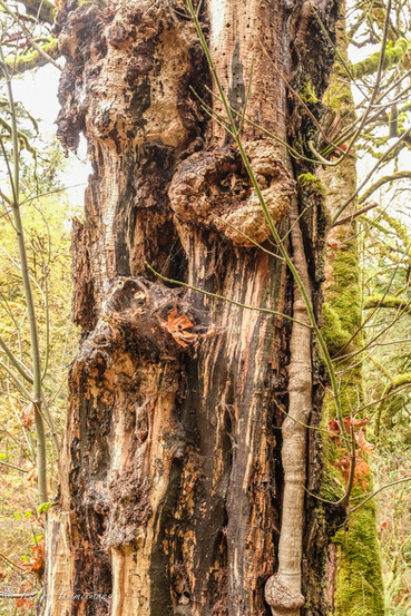
Unlike the previous hike, this one had no arbutus trees. But it did have an impressive grove of old-growth Douglas Firs and Gary Oak trees.


This giant bent over this lesser log with barely a break.


A cedar tree.


Salel coats the forest floor.


Overlooking Burgoyne Bay in Sansum Narrows-- southwest.


Gulf Islands -- north.

Fulford Harbour, Portland Island, the San Juan Islands and Mt. Baker can be seen from here --east.

We got back to our van just as the sun was setting -- south (this pic is a continuation of the pic above it).
Day 2


Salt Spring Island is such a quaint quiet place. The narrow country roads are lined with forest and small artistic displays or signs at the end of driveways that sell wares such as homemade honey, soap & flowers.

Peek-a-boo, I see you. When I looked at this pic on my computer I realized there's not one, but two deer in it.


These next three pics were taken by the Long Harbour ferry terminal.


Jocelyn Hill: 9.45 km / 505m gain / 434m high
I don't hear my name too often but to see it on a sign was a first. This hike followed alongside and high above Finlayson Arm. The following three hikes are north of Victoria and right beside eachother.

Gowlland Tod Provincial Park was created in 1995.


Finlayson Arm to our left as we followed the ridge line from south to north.


1) fungi 2) shore pine


Case slid his hand over the soft bark and said it was smooth as my bum. The second pic, well I think you'll get the gist.

The arbutus trees got paler in color at the higher (but not so high) elevations.


Pale orange and almost lilac tones.

On Jocelyn Hill.


Jocelyn Hill was officially named on a British Admirality chart in 1911, two decades before Canada became independent. Looking north towards Salt Spring Island.


Hike #4: Mt. Finlayson -- 9.56 km / 552m gain / 419m high / 2:35 hours MT
This hike involved some scrambling skills. Not a good one to do in the rain. Therefore we squeezed it into this day, hiking the last 3 km in the dark (with a head light).

We parked at the Goldstream Provincial Park day use area where the hemlocks and cedars were the largest we'd yet seen.


Goldstream Provinical Park was established in 1958. It was the site of a gold rush in the mid 1800s.

We walked over the bridge and then about 5 minutes down Finlayson Arm Road to the trailhead.


1) There were 3 sets of stairs on the first section of trail. 2) The gnarly bark of a bigleaf maple tree.


Careful steps on sometimes large smooth slabs of rock.

Berries of the arbutus trees in the fall.


Views from the summit of Mt. Finlayson. The burbs were not far off.

The trail formed a large loop, taking us up and over the summit and then down, doing the last 3 km on Finlayson Arm Rd.
Day 3:
Mckenzie Bight:

It was not our intention to do this one hour hike to McKenzie Bight but after hiking downwards about 10 minutes, we started to doubt that we were on the right track. So we asked a passing couple and they said, "No you are not on the Mt. Work trail". So if you see a big brown sigh saying"Mt. Work Regional Park", don't go there. The trailhead is in the parking lot, not across from it.

The local couple advised us to keep going to the beach and then go back up via the Cascade trail.

At the top of Cascade Falls.


At a junction we turned left onto the Timberlane trail.
Hike #5: Mt. Work -- 6.3 km / 383m gain / 449m high / 2:15 hours MT
Mt. Work is the highest peak on the Saanich Peninsula.


Here at the summit we turned back but you can continue on this trail to Jocelyn Hill which we could see to our left. Below us was Pease Lake and to our northwest was Saanich Inlet.


Popping with color.
Hatley Castle in Victoria.


8 pic slider of the Hatley Castle and it's surrounding gardens.

Odgen Point Breakwater was constructed from 1914 - 1917. As a result of immenent completion of the Panama Canal and increasing trade in the Pacific, Canada decided to build a 765m-long breakwater and docks in Victoria. It cost nearly $5 million.


More than 1 million cubic yards of locally quarried rock was dropped into deep water to support the main structure of 10,000 granite blocks. Each block weighed 15 tons and was stacked in a nine course pyramid. The breakwater was completed on schedule, despite the demands WWI was making on all kinds of resources.

I took this picture through the restaurant / pub window, located at the beginning of the pier.
Day 4:
The Butchard family began to shape Butchard Gardens in 1904.

The greenhouse has an open window you can take photos through.

The Sunken Gardens are constructed on the site of an abandoned limestone quarry.

The deepest part of the quarry was sealed, lined and allowed to fill with water from a natural spring forming a lake that is 40' deep.


Huge poplars.


Oodles of dahlias.


The rose garden had only a few lingering roses that were blooming yet.

Entering the Japanese gardens.


This beech tree is the oldest in the park.


A hole in the hedge.


The Star pond.

This Italian garden was created in 1926 on the site of the family's tennis court.
Downtown Victoria.

The parliament buildings.

The Empress Hotel.


This 4-metre tall, 60 metre long garden sculpture depicting a mother & baby orca riding a wave, is made with over 10,000 Ahernanthera, Santolina & Festuca plants and weighs over 5100 kg.


I really enjoyed the pictures, love the arbutus trees.