
Ravens Bluffs
- Jocelyn Timmermans
- Nov 3, 2022
- 3 min read
Nov. 2 - 8 km east of Mission
Stats: 8 Km / 605m gain / 471m high point / 3 hours MY
A local hike with pretty views of the Fraser Valley, lured 19 hikers out on this sunny clear day.
Besides the expansive views of the Fraser Valley, this hike offered some interesting features: a nudist beach (a bit too chilly for that), a cabin perched on a steep bank, a paragliders launch, a new memorial bench & even a geochache.

You cannot park by the Inch Creek Hatchery anymore. So we crossed the CPR tracks off of Hawkins Pickle Rd and parked at Norrish Creek bridge. Sheri & Joan led the way, branching left, off of the main trail that ran parallel to Norrish Creek. On the return we stayed on the main trail, thus forming a loop. Sheri & Joan met eachother years ago on this trail and formed a group (Hiker Babes), hiking it almost weekly.

This trail ran past the nudist beach.


A sign for their own private beach read, "Winstons Beach".

A little Dipper bird was perched on one of the rocks in the river.


Pic 2 shows the large section that slid off during the atmospheric rivers a year ago. Parts of the trail had slid away with it.


Sheri said the weeping rock forms beautiful icycles in the winter.

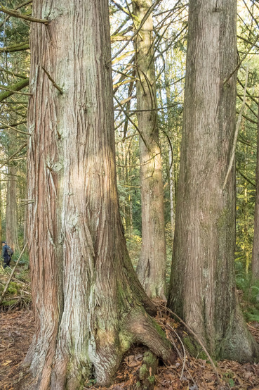
Back on the main trail.


View of Norrish Creek below, the west end of Sumas Mt, and Matsqui Flats in the distance - southwest.

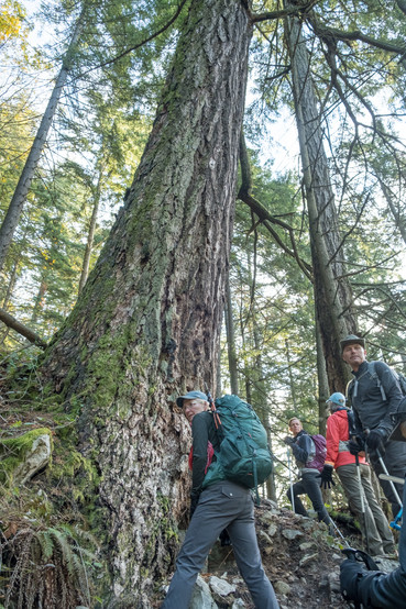
The first hour, from where we left the river to the T-junction, was quite steep. We turned left there.


At the tiny tree-house cabin. This is one of about 6 shelter huts built by Wulf Pirang in this area. He is 81 years old and still continues to work on the trails he built and on his secluded huts. He also built the Dewdney Grind cabin.

The little wood stove has been removed.


Views from the front of the cabin.

The Mission Bridge to the far right.

Slimy stalked-puffball.

It took about half an hour to get from the T-junction to the paragliders lookout.


Group shot: Back: Len S, Ling S, Back row: Miriam S, Richard S, Case T, Jerry B,
Middle row: Johnny B, Helen C, Cathy U, Sheri K, Joan A, Mary R, Darlene G
Front row: Carol A, Dave S, Dave S, Chris L, me, David G (who named himself Scotty for the day because he said there were enough Davids there already).

Seven of the group chose to return by way of a loop leading to the left, along the embankment. We ended up getting back to the vehicles within minutes of eachother.


The rest of us backtracked, past the cabin again and to the T-junction. We found a geocache but I won't tell you where.

At the T-junction we stayed straight (left) and soon got to this south-facing viewpoint.

Sheri was one of the people who helped carry pieces of wood up here and built this bench in memory of her friend, Wanda who died this year of cancer.

About 5 minutes walk past the viewpoint we dropped down a bit to this more expansive viewpoint.

Looking towards Deroche and Chilliwack with the Fraser River lining Sumas Mt. Mt. Baker stayed hidden behind the cloud to the right.

Mt. Slesse & Tomyhoi -- southeast.

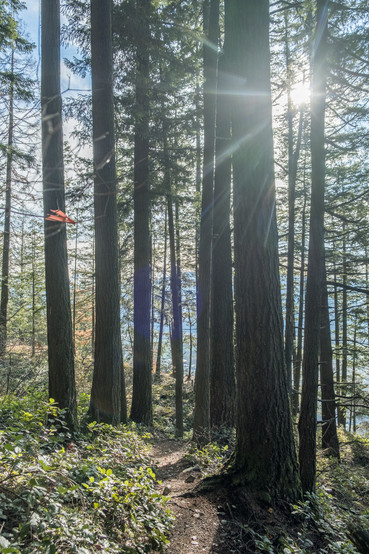
Heading back.

A big tree crossing the trail lower down.


Back at 2:00pm. Six of us went to the Historic Dewdney Pub. Their clam chowder soup was delicious!

Fishermen out and about by Norrish Creek.

The most northern point is the paragliders lookout. Nicomen Slough is the water in the lower right of the pic.
Comentarios