
January 9 -- 9 km / 523m gain / 1770m high / 4 hours MT
This was a first time snowshoe for me and I was impressed! I can see this winter route becoming more popular since it has much to offer. There was only a valley seperating the ridge we were on from high familiar peaks...

I'd never seen the parking lot this full before at the Manning Park ski resort. There were even vehicles parked alongside the road that led up to the resort!

Look familiar? That's because this same pic is in my most recent album of Poland Lake. Just two days later we returned to do Mara Peak. Why? Because thanks to two people who'd broken the trail Wednesday, part of our Thursday group branched off after doing Poland Lake and followed their trampled trail to Mara Peak. Some of us followed our drivers back to the cars.

I was one of those who headed back to the car but when I reached the groomed ski slope, three of us started climbing up instead of down. Maybe we'd still have enough time to reach the summit? As it turned out, we got within 12 minutes of it when we ran into the other group who said how beautiful it was on the ridge. So we just had to come back. Two days later we did and it proved to be a great delight. We now could take our time on a prefect weather day.
It took us 35 minutes to get to this point where we left the groomed slope and entered the forest, not far from the top of the blue chairlift.


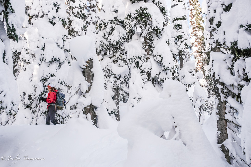


It took another half an hour to get to Mara summit.

And then came our "WOW!!!" moment. Couldn't get much better than this.

Frosty & Castle Mts -- southeast.

Hozameen & Red Mtns -- south.

Shawatum & Silverdaisy Mtns -- west.

Silverdaisy.


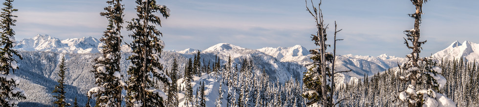


Southeast to west.

Starting to head west down the ridge.


There were some steep downs and a few ups and a few narrow sections on the ridge. And off course a few rather funny falls.

Whipcream.


Looking north at Bojo (1860m) & Grassy Peaks.


We settled down here, at the end of the ridge for lunch.

Silverdaisy Mt.

Leaving the ridge.


We turned right (north) to enter the forest.


After crossing this clearing we began to climb again. We soon passed Gibson Meadow. A creek lined with high snow banks framed the meadow so we decided to continue uphill on the trampled trail that would connect with the Poland Lake route from 2 days prior.


Pic 2: A marshmellow.

During the steep ascent I began to think that maybe it would've been easier to stay lower and break trail in knee deep snow to the meadow. When we arrived at the connector Poland Lake trail, it was with some relief that the uphill was done. Anne confessed she let an unsavory word slip during the climb (we forgive you Anne) as the high body-hoisting steps were becoming increasing hard to do in the afternoon snow that was becoming soft and slippery.


Fingers of winter's long shadows.

A cookie.


It was nice to drive home in daylight (unlike Thursday) and avoid the skiers rush-hour.

I forgot to take my Garmin 66i GPS along so this is all I've got to show you. Next time better...
Commenti