
Dec. 31, 2020 -- Stats: 21.11 km / 631m gain / 154m high point / 5:45 hours MT
I didn't think we'd be able to do the whole loop because the floating bridge at the opposite end of the oblong lake is still, after all these years, not fixed. But that ended up being just another challenge and adventure for us...

We parked at the northeast end of the lake, just off of Dewdney Rd. The yellow gate opens at 9:00am and closes at 3:30pm. At the opposite end of the lake it closes at 4:00pm.

Crossing over Steelhead Creek. We did the loop clockwise. There were many wood bridges on this south side of the lake.

A short side trail led to Steelhead Falls.


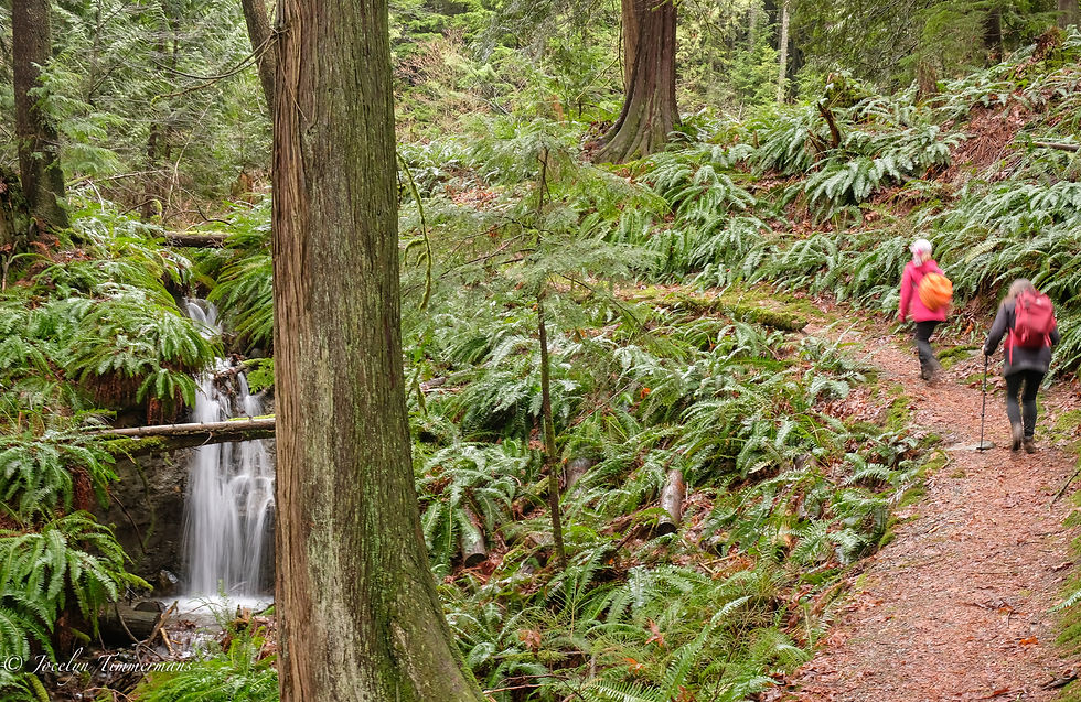
Back on the Hayward Lake Reservoir Trail.


Anne said next year we should have Thanksgiving dinner here.


Anne pushed the moss aside and showed us what looks like a petroglyph. She used to walk this trail regularily with her friend.


Henry & Michelle.


Snotty mushrooms. I'd never seen this before.


This ended up being the only spot where we stopped for a break.


Blending back into the forest.


I'd read the account on-line of a few people that had succeeded in doing a detour around the arm of water south of the broken bridge. We kept an eye out for orange tree tapes. Just before the drop off to the bridge, we saw them. The footpath was very doable, with a bit of bushwhacking and ample tapes to mark the way.

Farther upstream the tapes led us a bit south of this photo. I crossed first, having taken my boots off. When Janice & Anne saw me, with my long legs, sink up to my thighs in the frigid water, they decided to take their chances on these two logs.


Janice went first, on all fours. She's instructing Anne in the left pic. Anne scooted over on her bum.

Bound and determined.

At first we didn't see anymore tapes having reached the other side of the river. So we climbed onto the highest bank where we saw a house to our left. About 15 minutes later when we came to the "if only" bridge, we saw a taped trail coming out of the forest a bit lower down. So somehow we'd missed it but six-or-half-a-dozen, both got us there.

Looking back at the arm of water that we'd just hiked around.

Crossing on top of the Ruskin Dam which was built 1929 - 1930. For over 40 years the railway delivered equipment & supplies from Ruskin to Stave Falls.

On the other side of the lake we were walking on the route of what was once Canada's shortest incorporated railways. In the early 1900s, the original rail line delivered supplies for the construction of the Stave Falls Dam. It also transported passengers & mail and brought loads of logs & shingles to Ruskin. In 1921 eletric trains replaced the old coal-burners.


Just before the beach, we passed by oodles of eagles standing sentinel above us.


Crossing over the Stave Falls Dam above the defeaning roar of the water.
Just past the dam we got back onto the trail which led steeply upwards and soon back to the parking lot. We had only 15 minutes to spare before the gates shut.


Comentários