
Nov. 11 - Stats: 10.10 km / 766m gain / 4:10 hours MT / 733m high point
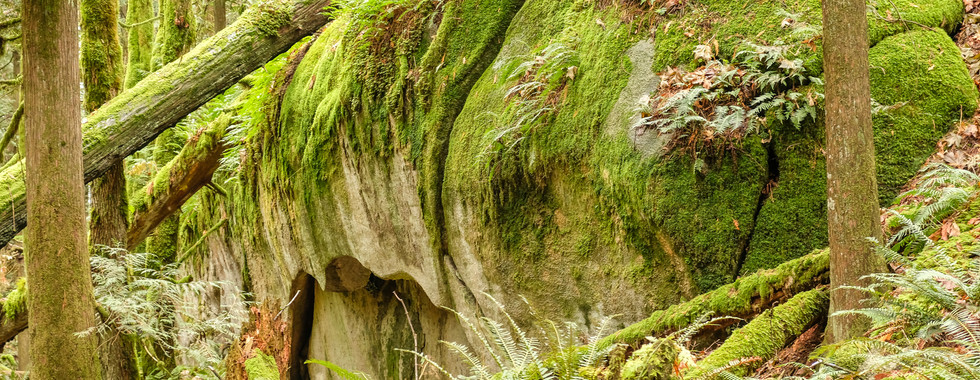
This is the trail to Campbell Lake. But we turned back at the viewpoint as the clouds remained low, totally obscuring any views to be had. At that point we'd done most of the elevation gain to the lake which would've been another half hour walk. The outstanding feature about this steep hike is the truck-size moss-covered boulders.

The first stretch before the large concrete water tank, involved walking on wet rock & leaves on a steep incline.

In about half an hour we crossed under the power lines, on this clear-cut strip.


No Mt. Cheam to be seen on this day -- south.


Charlie & Clover were scooting & scouting ahead of us.


Some interesting rock formations and slick tricky sections.


Talk about roots!


This pic makes me think of icing sugar.


The snow started at 450m.


There was no view from the northern viewpoint. I added this pic (not mine) to show you what it should've looked like; Harrison River and Lake with its islands.

Puff & such.

Celebrating Terry's birthday in a most fitting way.


Henry said the micro-spikes coming down were a "lifesaver".
Comments